Beyond Contours
If you've mastered the art of reading contour lines you're well on your way to understanding the formation of the land and how those squiggly lines transform into real life features of the world around us.
Land Shapes
While terms like 'hill' and 'valley' might come to mind when picturing the terrain, navigating, especially in mountainous regions, demands a more refined vocabulary. Let's delve into the world of specific landforms, their characteristics, and how they're depicted using contour lines.
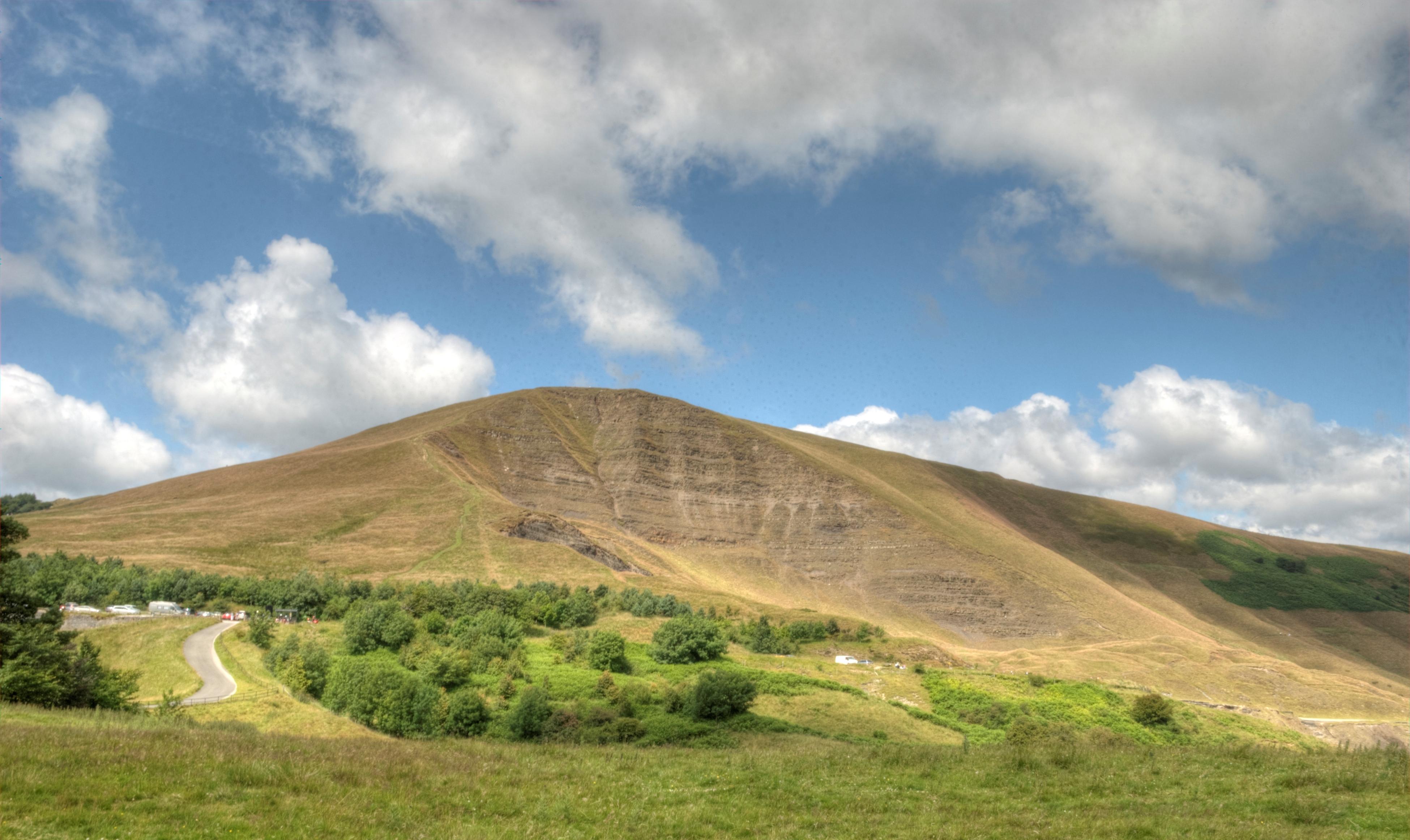
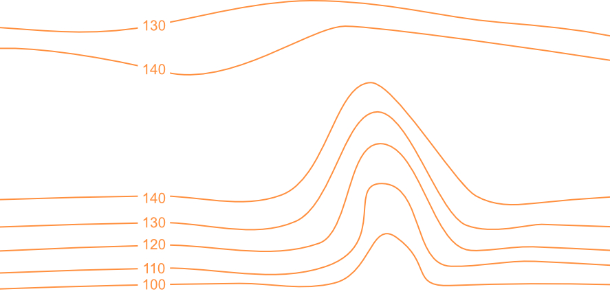
Knoll: A lonely hill
[Source]
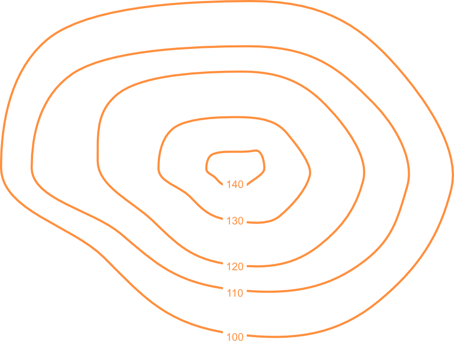
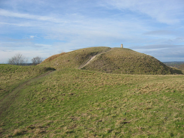
A knoll is a small, isolated hill that rises gracefully from a relatively flat surrounding area, usually with a rounded top; Think of a hobbit's house.
Totternhoe Knolls in Bedfordshire, perhaps unsurprisingly given it's name, is a great example of a knoll. It rises above an area of largely flat land surrounding it.
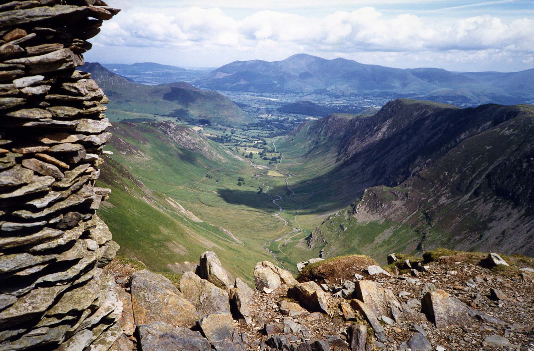
Ridges: The backbone of the land
[Source]
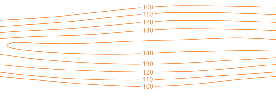
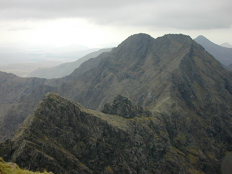
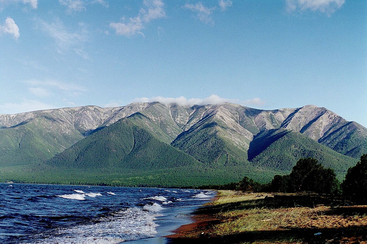
Imagine a winding ribbon of land, raised above the surrounding terrain, stretching far and wide – that's the essence of a ridge. They can be thought of as elongated hills, being significantly longer than they are wide. Ridges serve as natural pathways, connecting higher elevations like stepping stones across a landscape.
Cuillin Ridge, on the Isle of Skye, adorned with jagged peaks, epitomises the essence of a ridge, offering breathtaking views and challenging hiking.
[Source]
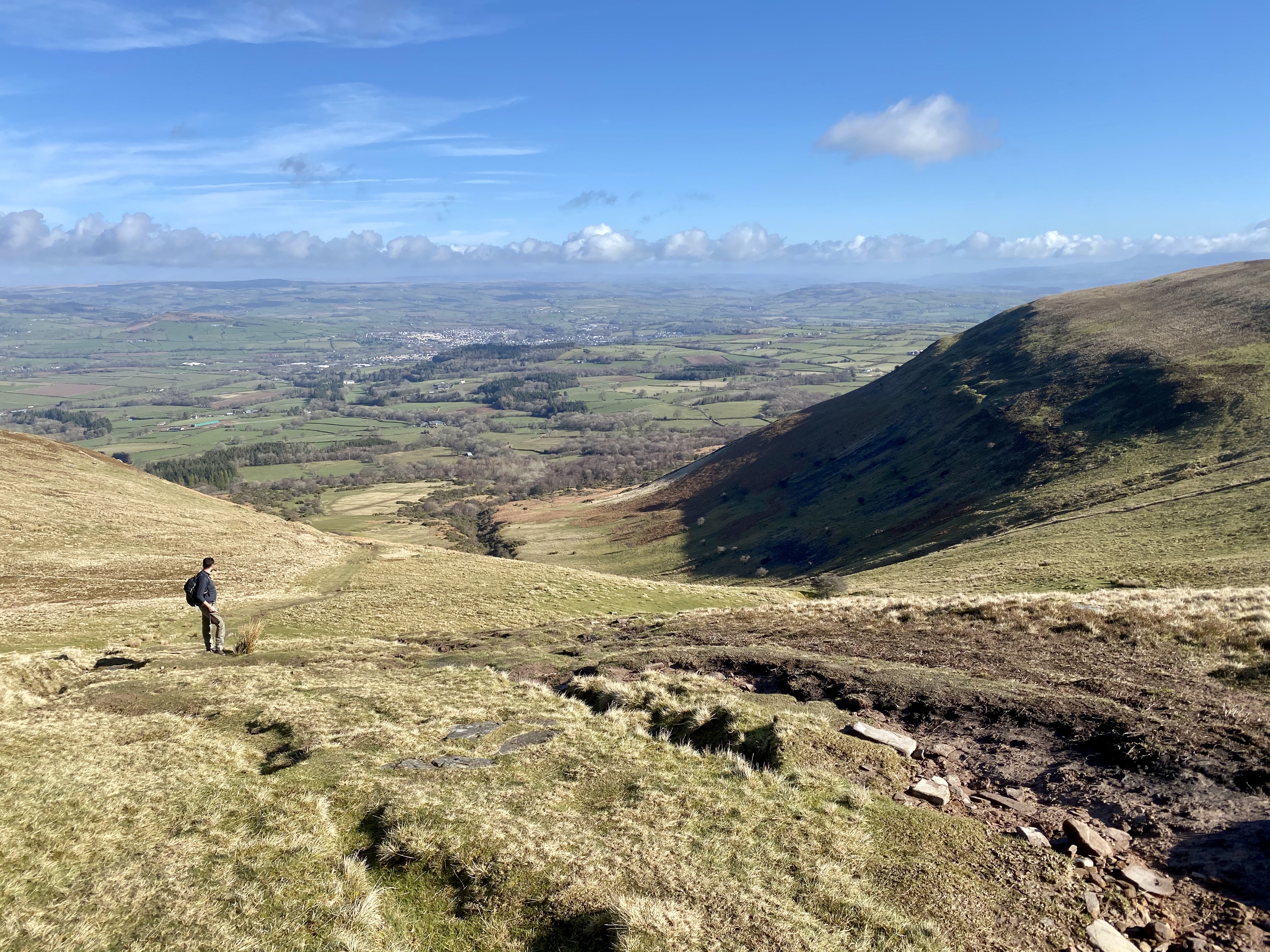
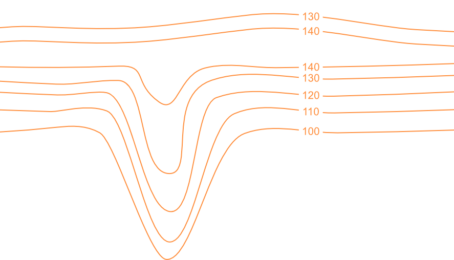
While ridges embody elevation and prominence, valleys represent the inverse – elongated depressions carved into the earth's surface. Often referred to as 'dales' in the north, they wind through landscapes, providing great vistas across and along their span.
Newlands Valley, nestled amidst the rolling hills of Cumberland, stands out as a particularly beautiful example.
Escarpment: When things take a dramatic turn
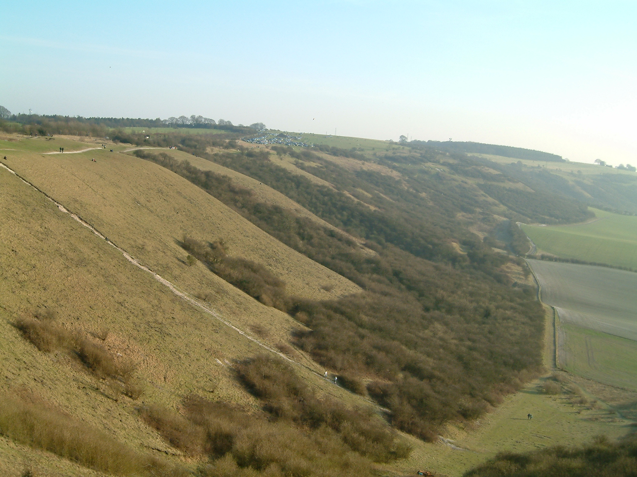
[Source]
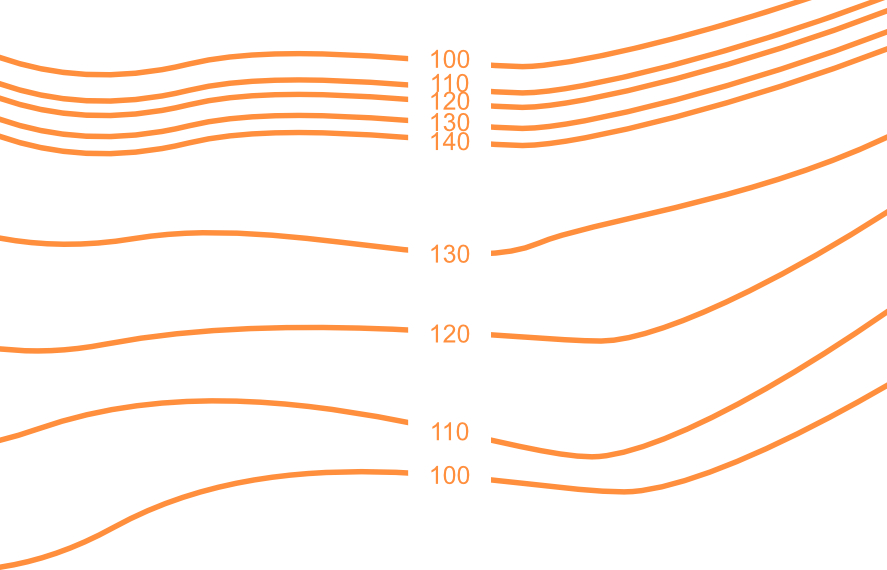
Escarpments, similar to ridges, are elongated landforms that rise gracefully from the surrounding terrain, often forming dramatic transitions between two distinct elevation levels. Unlike ridges, however, escarpments exhibit a distinct asymmetry, with one side sloping gently and the other plunging abruptly. This characteristic topography, much like a cliff, is the hallmark of an escarpment.
Dunstable Downs, serves as a good example of this landform. Its gentle ascent from the lowlands gives way to a sudden, dramatic drop providing a panoramic view of the surrounding landscape for miles - I'm told that on a clear day you see all the way to the Cotswolds!
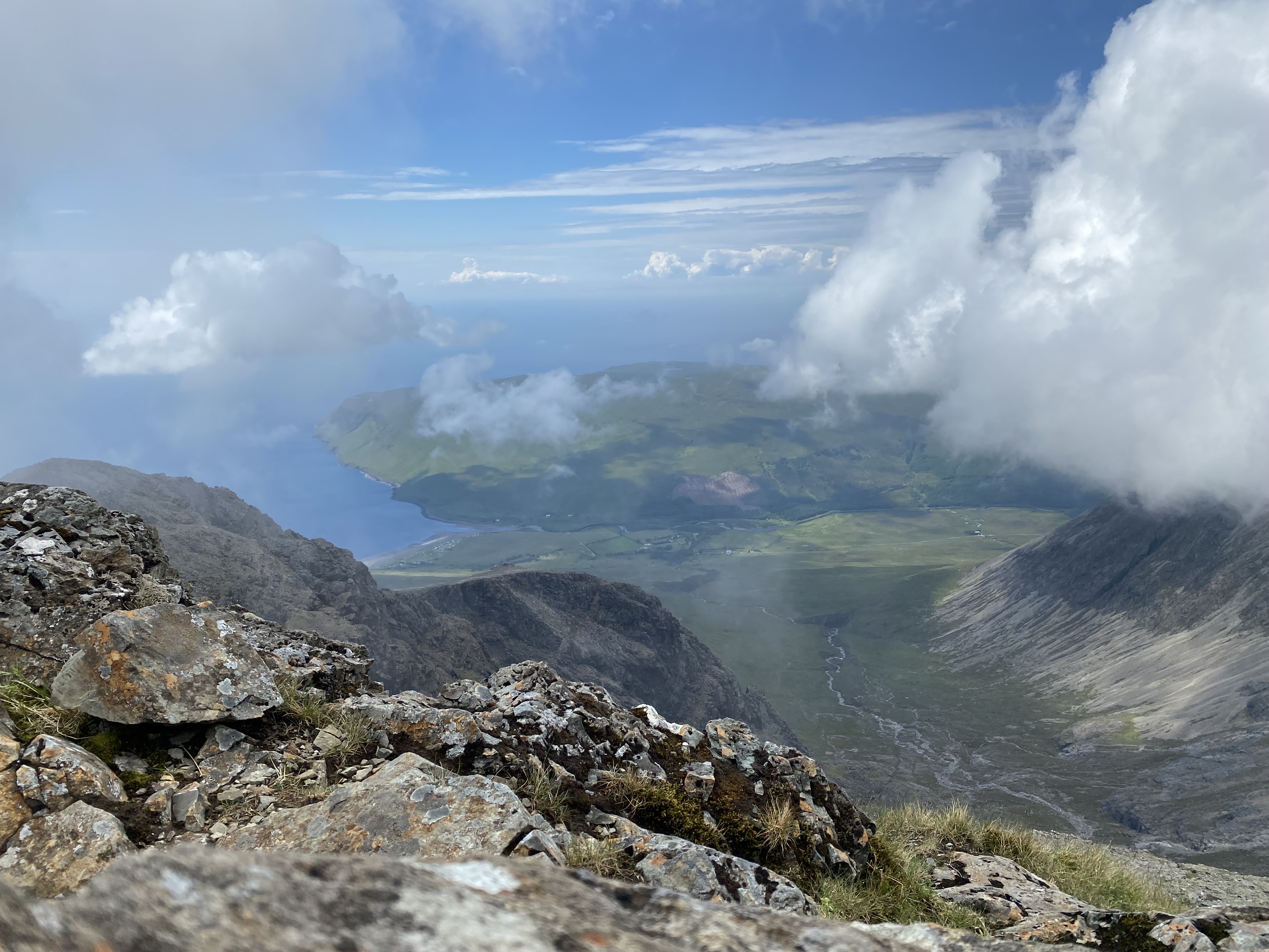
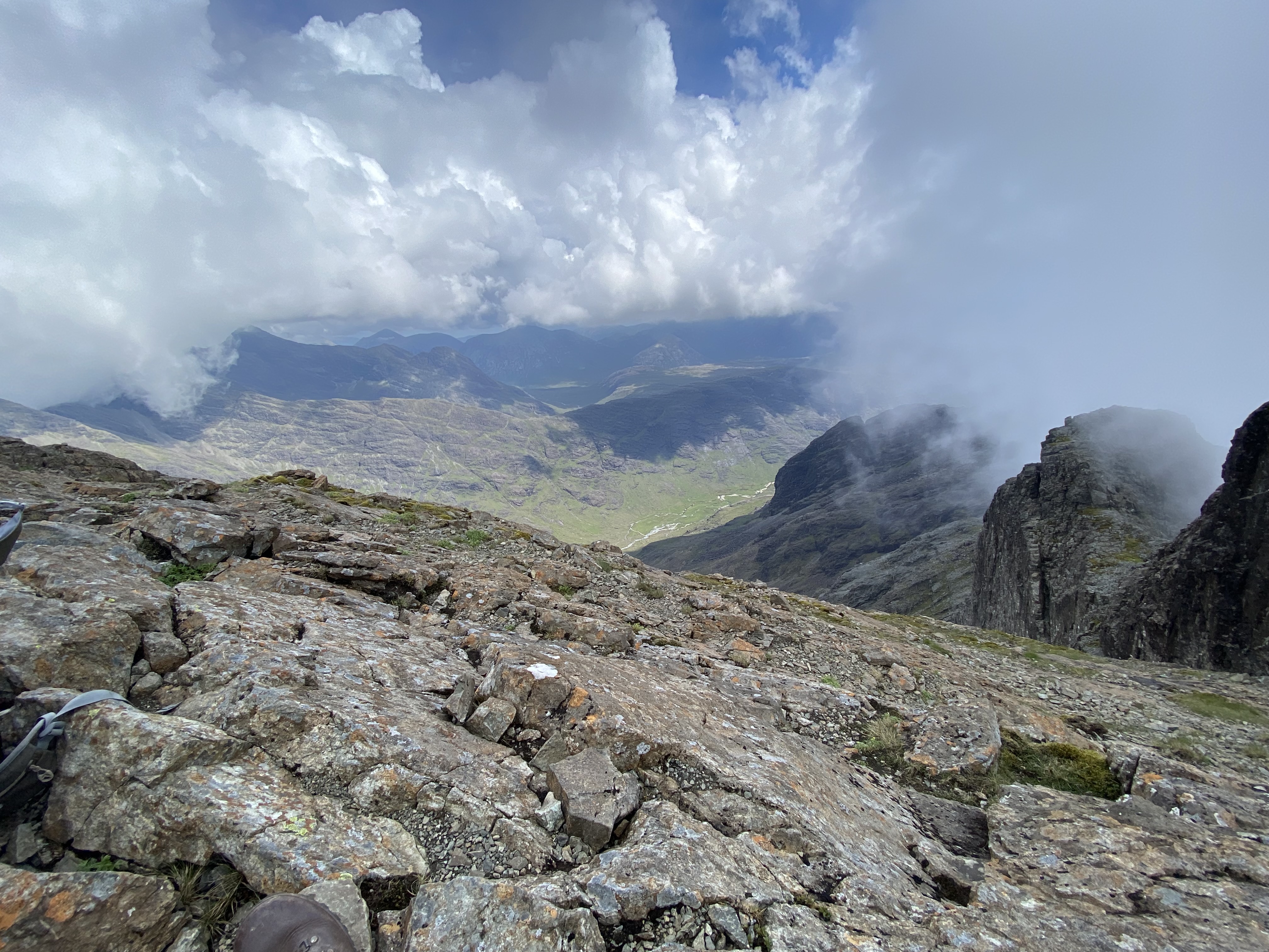
Saddle / Col: Nature's resting points
[Source]
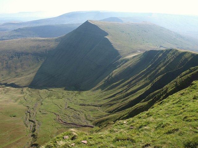
A Saddle, which may also be referred to as a Col or a Gap, is simply the low point between two summits. These natural pathways provide a convenient route for hikers and climbers to traverse between peaks, often offering breathtaking vistas along the way.
Craig Cwn Sere, nestled between the iconic peaks of Pen Y Fan and Cribyn in the breathtaking Brecon Beacons, exemplifies the essence of a saddle - although I have to say it's not my favourite thing to climb out of towards Cribyn having already summitted Corn Du and Pen Y Fan 😛.
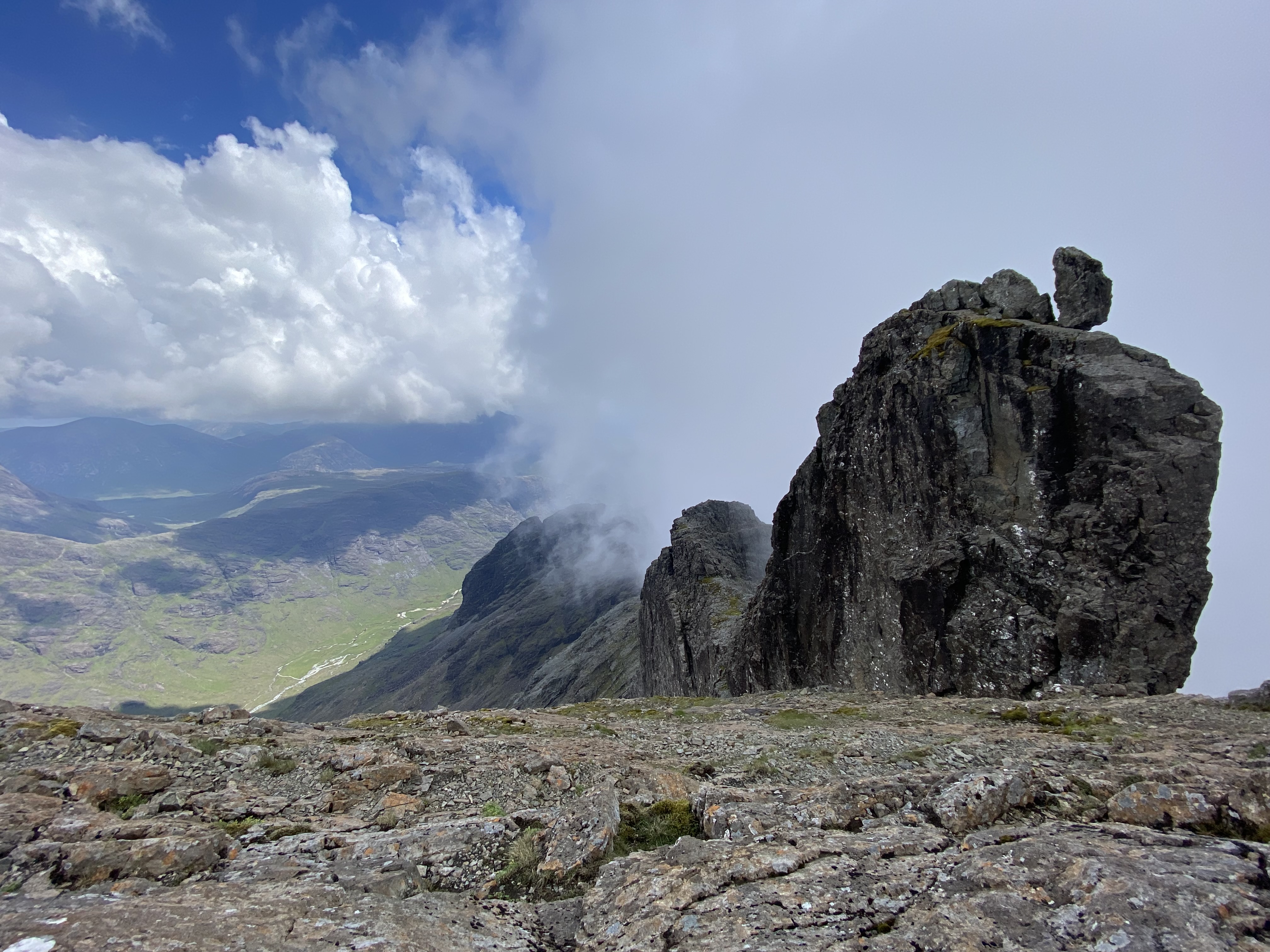
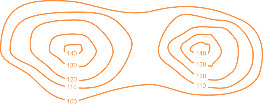
Spurs and Re-entrants: The land's fingers
Imagine reaching out your hand. The spurs are like your outstretched fingers, branching off from the main ridgeline of a mountain or hill. These lateral ridges can extend for various lengths, and sometimes even interlink, forming a network of smaller ridges. They offer natural pathways for hikers and climbers, guiding them along the mountainous spine.
[Source]
Now, imagine closing your fingers inward, creating indentations between them. These indentations are like re-entrants, the valleys nestled between spurs. They're similar to miniature valleys, but unlike their larger cousins, they don't run parallel to the ridgeline. Re-entrants are perpendicular, their contours rising with the surrounding land. Unlike spurs, which provide convenient paths, re-entrants often become natural drainage channels for water, carving their way down the hillside.
#GoForIt
So there you have it, a crash course in the language of landforms! From the humble knoll to the dramatic escarpment, each feature plays a vital role in shaping the landscapes we explore and admire. Get yourself out there, armed with this newfound vocabulary, and explore the world with confidence, knowing that the land itself can be your greatest navigation tool.